Felix Andries Vening Meinesz and his Gouden Kalf; Or, how the Koninklijke Marine played a crucial role in the history of ocean gravimetry, part 2
Good morning / afternoon / evening, my reading friend and welcome to the second part of this article on the underwater gravimetric research conducted by the Dutch geophysicist / geodesist Felix Andries Vening Meinesz, in cooperation with the Koninklijke Marine. Shall we begin our deep dive? Wunderbar!
The Carnegie Institution, an American private organisation involved in the funding and performing of scientific research, was suitably intrigued by what Vening Meinesz had accomplished between 1923 and 1927. It suggested that the American government take similar measurements in the Caribbean Sea, using a submarine of the United States Navy. That suggestion got the nod.
Several American organisations soon joined that gravimetric expedition project, including the National Academy of Sciences, the United States Coast and Geodetic Survey, the United States Naval Observatory and the United States Navy Hydrographic Office.

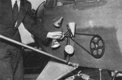
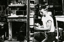
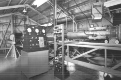
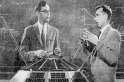
The gravimeter used by Felix Andries Vening Meinesz during his journey aboard the United States Navy submarine USS S-21. F.A. Vening Meinesz and F.E. Wright, “The Gravity Measuring Cruise of the U.S. Submarine S-21.” Publications of the United States Naval Observatory, Second Series, Vol. XIII – Appendix I (Washington: United States Government Printing Office, 1930), between pages 14 and 15.

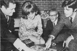
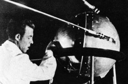
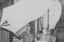
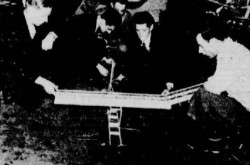
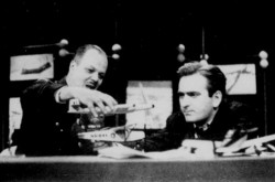
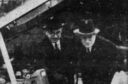
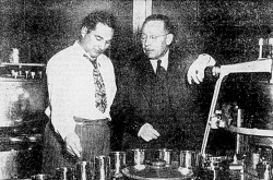
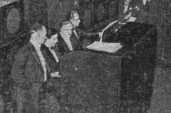
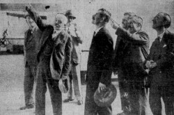
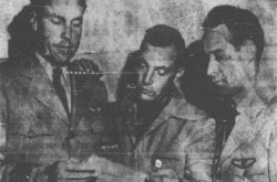
Felix Andries Vening Meinesz, on the far right, with the gravimeter used during his journey aboard the United States Navy submarine USS S-21. The other individuals were, from left to right, Curtis Dwight Wilbur, United States Secretary of the Navy, and Captain Charles Seymour Freeman, Superintendent of the United States Naval Observatory. F.A. Vening Meinesz and F.E. Wright, “The Gravity Measuring Cruise of the U.S. Submarine S-21.” Publications of the United States Naval Observatory, Second Series, Vol. XIII – Appendix I (Washington: United States Government Printing Office, 1930), between pages 16 and 17.
Incidentally, an uncropped version of the photograph you have just seen included Vening Meinesz’s coauthor, Frederick Eugene “Fred” Wright, an American scientist / petrologist / geophysicist working at the Geophysical Laboratory of the Carnegie Institution.
USS S-21 set sail in early October 1928 and yes, Vening Meinesz was on board with his measuring equipment. It and he returned 8 or so weeks later, in late November. The 45 or so measurements taken uncovered a number of significant negative gravity anomalies, in other words, regions of the Earth where the force of gravity was generally lower than normal. Such anomalies were found in ocean trenches, which meant that those regions of the Earth’s crust were geologically active.
The odd thing was that such anomalies and activity did not fit what scientists knew, or thought they knew, about the structure of the crust of our planet. You see, at the time, said scientists thought that the Earth’s continents had always occupied the position they were occupying in the 1920s.
The negative gravity anomalies uncovered in 1928 were some of the first tangible evidence of the continental drift hypothesis put forward in 1915 by the German climatologist / geologist / geophysicist / meteorologist / polar researcher Alfred Lothar Wegener and, to some extent, before that, in 1906, by the Austro-Hungarian alpinist / geologist Otto Ampferer.
According to Wegener, the continents of our big blue marble had moved, or drifted, relative to each other, and this for a very loooong time.
Even though Wegener’s ideas were rejected by the bulk of the scientific community, the members of said community nonetheless had to recognise that the coasts of South American and Africa had similar shape and seemed to have fitted together at some point in the distant past.
And yes, Vening Meinesz was one of the scientists who rejected Wegener’s ideas. This being said (typed?), he seemingly kept an open mind.
By the way, yours truly was puzzled by that similarity of the shape of the coasts of South America and Africa when my parents bought me a terrestrial globe, almost 60 years ago. Great minds think alike, do they not? And yes, I am a deeply humble person.
Incidentally, again, I vaguely and I do mean vaguely recall coming across information about continental drift in an early 1970s schoolbook, but I digress.
As you and I both know, the continental drift hypothesis was eventually confirmed. Indeed, several papers published between 1965 and 1967 defined a new paradigm, the theory of plate tectonics, which quite simply revolutionised Earth sciences.
And no, a scientific theory is not some flighty opinion or conjecture of little import. A scientific theory is a strongly supported explanation of a certain aspect of the natural world. Plate tectonics is a scientific theory, as are evolution and general relativity. By comparison, creationism is not, but I digress.
It was in the late 1960s that scientists realised that ocean trenches were the places where a plate with a thinner yet less buoyant oceanic crust went underneath a plate with a thicker yet more buoyant continental crust, thus producing the negative gravity anomalies – as well as more than a few earthquakes and volcanic eruptions.
One of those subduction zones, as those regions are called, extends from northern California all the way to southern British Columbia.
Please note that what follows is quite horrific.
When, and not if from the looks of it, an earthquake many people refer to as the Big One hits, the northwest edge of North America might, I repeat might, in a worst-case scenario, drop by as much as 1.8 or so metre (6 or so feet) and bounce back 10 to 20 or so metres (30 to 65 or so feet) or more to the west, and this in a matter of minutes.
Some of that movement would of course take place underneath the Pacific Ocean, displacing a huge amount of water. That water would surge upward, forming a huge hill, then collapse. Part of that water would rush toward Asia. The rest would rush east and hit northern California, Oregon, Washington and southern British Columbia.
Within 15 to 20 minutes of the onset of the Big One, that entire region of North America would be unrecognisable. Thousands of people could perish.
The water rushing toward Asia, on the other hand, would hit the shores several / many hours after the onset of the earthquake, which might allow many people to flee to higher ground. Even so, that region would also be seriously devastated. Thousands of people could perish.
Such an apocalyptic Big One could plunge the world into another Great Depression.
Let us move away from that abyss, shall we, my utterly shocked reading friend?
The results of the 1928 journey of USS S-21 were published in 1930 by the United States Naval Observatory.
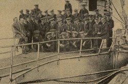
And yes, my still rattled reading friend, the photograph with which we began our journey with Vening Meinesz, in the 1st part of this article, showed our scientist with the crew of USS S-21, but back to our story. And I do apologise for rattling you.
The discovery of significant negative gravity anomalies in 1928 led to a second American gravimetric expedition, known as the Navy-Princeton Gravity Expedition to the West Indies, which took place in the Caribbean Sea in February and March 1932, using the submarine USS S-48. And yes, Vening Meinesz was on board with his measuring equipment.
He was not present, however, during the Gravimetric Survey Expedition which took place in the Caribbean Sea between late November 1936 and mid January 1937, using the submarine USS Barracuda.
Mention should also be made of the several gravimetric measurements carried out by a member of the Wilkins-Ellsworth Trans Arctic Submarine Expedition in August and September 1931, in the Arctic Ocean, north of the Spitsbergen archipelago, today’s Norwegian territory known as Svalbard. Those measurements were made by the German arctic explorer / mountaineer / physician / skier and movie actor / director / producer / screenwriter Bernhard Villinger using a gravimeter purchased in the Netherlands.
Villinger was then part of the crew of the Nautilus, ex-USS O-12, a submarine of the United States Navy retired from service in June 1924, leased in 1930 for a nominal annual fee, then modified for its very special mission: reaching the North Pole by sailing under the ice.
Poorly suited to its mission and damaged along the way, the Nautilus only made a few more or less controlled brief dives under the pack ice. This being said (typed?), those rather risky dives were the first ones ever made under pack ice by a submarine.
Judging the expedition to be a failure, one of its main sponsors, an American businessman / print magnate who was passionate about the Arctic, William Randolph Hearst, refused to pay the expected sum of money.
Before we go back to Vening Meinesz, yours truly would like to digress, and pontificate. You see, the Koninklijke Marine and the United States Navy were not the only military forces involved in underwater gravimetric research during the interwar years. Nay.
Indeed, an associate professor / geophysicist by the name of Leonid Vasilievich Sorokin was aboard a submarine of the Black Sea fleet of the Morskiye Sily Raboche-Krest’yanskoy Krasnoy Armii SSSR in August and September 1930 to conduct experimental gravimetric measurements. That first run was sufficiently successful to warrant further expeditions made by the naval forces of the workers’ and peasants’ red army of the USSR in the Black Sea (1933-35), the Sea of Japan (1937) and the Sea of Okhotsk (1937).
Incidentally, Sorokin worked in Moskva / Moscow, Union of Soviet Socialist Republics (USSR), at the Moskovskiy Gosudarstvennyy Universitet or the Institut Issledovatel’skogo i Opytnogo Dela, in other words the Moscow state university or the institute of research and experimental work.
But wait, there was more. Italy’s Regia Marina was involved in 2 submarine expeditions in the Mediterranean Sea during the interwar years. The first was made between August and October 1931 by the crew of RN Vettor Pisani, using a gravimeter loaned in July by the Rijkscommissie voor Graadmeting en Waterpassing and…
Yes, that gravimeter was loaned by the organisation Vening Meinesz was heavily involved with. Indeed, the device used by the Italian engineer / topographer and secretary of the Comitato per la geodesia e geofisìca of the Consiglio nazionale delle ricerche was the one Vening Meinesz himself had been using. Better yet, Gino Cassinis learned how to use it from the Dutch scientist himself, in Italy. Incidentally, the gravimeter returned to the Netherlands in October 1931. By air.
In any event, when it decided to launch a second expedition, the Regia Commissione geodetica italiana found itself unable to borrow that precious instrument. The Koninklijke Marine was preparing an expedition of its own, you see. As a result, the Italian organisation had to order a gravimeter from Naamloze Vennootschap Nederlandsche Seintoestellen Fabriek, the largest radio equipment manufacturing firm in the Netherlands.
Cassinis and his gravimeter sailed aboard RN Des Geneys in July and August 1935, and covered a great deal of, err, ground in the waters of the Mediterranean Sea.
Topping that off, the Dai-Nippon Teikoku Kaigun was involved in underwater gravimetric research when the submarine Ro-58 put so sea in October 1932 to conduct experimental measurements near Yokohama, Japan. The scientist responsible was a well-known Japanese geophysicist / professor. That same scientist, Matuyama Motonori, born Matsuyama Motonori, sailed aboard Ro-57 in October and November 1934 to take a series of measurements off the shores of Japan, in the Pacific Ocean. Matuyama took more measurements in October 1935, aboard the mine-laying submarine known at the time as I-24.
And yes, the Sokuchi Linkai, in other words the Japanese geodetic committee, I think, had ordered 2 gravimeters from Nederlandsche Seintoestellen Fabriek.
By then, yes, by 1935, another navy had become the 6th military force involved in underwater gravimetric research. You see, France’s Marine nationale conducted 2 submarine expeditions in the western half of the Mediterranean Sea, a series of dives made by Fresnel between November 1932 and January 1933, and another series of dive made by Espoir between May and July 1936. The person responsible for those projects was Pierre Marti, the highly respected chief hydrograph engineer of the Service central hydrographique of the Ministère de la Marine. In at least one case, the gravimeter used had been loaned more or less directly by Vening Meinesz.
In 1938, the Royal Navy became the 7th military force involved in underwater gravimetric research, and this thanks to the lobbying of the Department of Geophysics and Geodesy of the University of Cambridge, in… Cambridge, England, and the cooperation of the Hydrographic Department of the Admiralty. Vening Meinesz having graciously agreed to loan a gravimeter to his English colleagues, the minelaying submarine HMS Narwhal set sail in September 1938 with the English geophysicist Benjamin Chapman Browne.
Only 2 measurements were made, however, before the cruise got cancelled. You see, a crisis was coming to a boil at the time.
National Socialist Germany wanted to take over a part of Czechoslovakia where most of the population spoke German, and this by force if necessary. As Europe held its breath, waiting to see if war would break out, the frightened prime ministers of the United Kingdom and France, Arthur Neville Chamberlain and Édouard Daladier, respectively friend and ally of Czechoslovakia, the last democratic country in that region of Europe, knelt before the monstrous German dictator, Adolf Hitler, allowing him to easily occupy the Sudetenland border region.
The Czechoslovakian government, the party most affected by this vile stab in the back, was not even invited to take part in those “negotiations.” With friends and allies like those, who needs enemies?
In any event, that shameful betrayal signaled the end of underwater gravimetric measurements during the interwar years.
And yes, my astute reading friend, it was quite likely that the expeditions launched by the USSR, Japan, Italy, France and the United Kingdom were directly inspired by the work done by Vening Meinesz, but back to our main character.

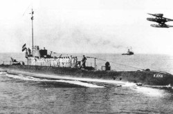
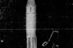
The submarine Hr.Ms. K XVIII of the Koninklijke Marine as it left on its journey to the Netherlands East Indies, November 1934. F.A. Vening Meinesz. Gravity Expeditions at Sea, 1934-1939, vol. III – The expeditions, the computations and the results (Delft: Drukkerij Waltman, 1941), between pages 14 and 15.
Vening Meinesz left the Netherlands in mid November 1934 aboard Hr.Ms. K XVIII, as that submarine sailed from the Netherlands to its base of operation, yes, the Netherlands East Indies. And yes again, that expedition was the one which prevented the Regia Commissione geodetica italiana from borrowing a gravimeter in the Netherlands.
The main goal of the very well-planned expedition of Hr.Ms. K XVIII was, among other things, to take measurements in various environments, over continental shelves and abyssal plains as well as in both hemispheres of our big blue marble.
The 37 000 or so kilometre (23 000 or so statute miles / 20 000 or so nautical miles) journey made by Hr.Ms. K XVIII, the longest made up to then by a submarine, might or might not have been the first made under the auspices of the aforementioned Rijkscommissie voor Graadmeting en Waterpassing, an organisation known from 1937 onward as the Rijkscommissie voor Geodesie.
And yes, my publicity-conscious reading friend, the stupendous journey of Hr.Ms. K XVIII was widely covered by the press of the Netherlands. Eager as it was to promote itself, the Koninklijke Marine made sure of that.
You see, the reputation of that service was at a low point at that time. You see, again, the financial chaos caused by the Great Depression had led to cuts in salaries aboard ships operating in the Netherlands East Indies and, perhaps, in the Netherlands. In early February 1933, utterly fed-up Indonesian crew members of an old coastal defence battleship, Hr.Ms. De Zeven Provinciën, took over that ship without injuring anyone and set sail toward the Koninklijke Marine’s main base in the area, to have their grievances heard.
The utterly shocked colonial authorities gave their blessing to an attack to stop what they deemed to be as a mutiny which was damaging the prestige of white male Homo sapiens in the Netherlands East Indies.
Contrary to what the leadership of the Koninklijke Marine had stated it would do, the pilot of a flying boat seemingly dropped a bomb on the warship on purpose, rather than at some distance in front of it, and this on the fifth day of that tragic affair. Close to 25 people died, either on the spot or of their wounds, the great majority of them Indonesian.
While some members of the Tweede Kamer der Staten-Generaal on the left of the political spectrum showed sympathy for the sailors, at least two of the most vocal ones ending up in jail, for 3 and 5 months, for their trouble, pretty much everyone on the right of the political spectrum in the lower house of the parliament of the Netherlands demanded that they be severely punished.
In the end, many Indonesian sailors were thrown in jail, where they remained until the takeover of the Netherlands East Indies by the Japanese armed forces in the spring of… 1942.
Having broken one of the unwritten commandments (the 11th? the 12th?) that we, underlings / subordinates / minions / menials / lackeys / hirelings / flunkies / employees / assistants / aides / etc., have to live by, namely “thou shalt not embarrass the boss,” the high command of the Koninklijke Marine very much wanted to publicise the journey of Hr.Ms. K XVIII, hoping that no one would screw up, of course, but back to our story.
To give Vening Meinesz as good an occasion as possible to conduct his experiments, the crew of Hr.Ms. K XVIII had to make its journey by a somewhat circuitous route, which included stops in South America and Southern Africa.
The submarine arrived in the Netherlands East Indies around mid July 1935, 8 or so months after its departure from the Netherlands, and no one had screwed up.
Along the way, Hr.Ms. K XVIII had stopped in many harbours on the shores of Africa and Asia, harbours used in past centuries by a famous trading company, one of the first joint-stock companies in the world in fact, the Vereenigde Oostindische Compagnie, whose ships had sailed the ocean blue in the 17th and 18th century, between the Netherlands and the Netherlands East Indies.
And yes, the officers of Hr.Ms. K XVIII had tried to convince representatives of the Armada de la República Argentina and Marinha do Brasil that they should consider buying submarines built for them in the Netherlands. Battered by the Great Depressions, those two navies politely declined.
Can you imagine yourself, my reading friend, aboard a submarine like Hr.Ms. K XVIII, sharing a cramped space with 34 other human beings for 8 or so months? I, for one, cannot. I will not.
All in all, Vening Meinesz took measurements in more than 255 locations, including 30 or so on land.
Those latter measurements were made with a gravimeter which had not been designed by Vening Meinesz. That piece of equipment had been graciously lent by the main oil producing entity in the Netherlands East Indies, Bataafsche Petroleum Maatschappij Naamloze Vennootschap, a subsidiary of the Royal Dutch Shell group, a peculiar entity formed in 1907 by firms based in the Netherlands and United Kingdom, namely Naamloze Vennootschap Koninklijke Nederlandsche Maatschappij tot Exploitatie van Petroleumbronnen in Nederlandsch-Indië and Shell Transport and Trading Company Limited.
And yes, that was a loooong sentence. Where is an em dash when you need one? (Hello, EP!)
And you have a question, my reading friend. Why did an oil producing entity need a gravimeter, you ask? A good question. You see, the gravitational field of our planet is distorted by variations in the density of rock layers underneath our feet. One of the largest variations is the one caused by the close proximity of rocks and large amounts of salt. It so happened that so-called salt domes often trap natural gas or oil.
Using a gravity measuring device known as a torsion balance, Austro-Hungarian scientists conducted the first gravimetric survey linked to oil prospecting in 1915, near Egbell, Austria-Hungarian Empire, today’s Gbely, Slovensko / Slovakia. As was to be expected, given the war which was devastating Europe at the time, the results of that experiment were known to only a few people. With the return of peace, torsion balances and gravimeters gradually became rather popular tools within the oil industries of several countries.
Incidentally, the gravimeter loaned to Vening Meinesz had been developed in Paris, France, in 1930 by two French physicists, Fernand Holweck, a university lecturer, and the jesuit Pierre Lejay.
Let us go back to our main topic, shall we? But then, only next week. Sorry.


![A block of photographs showing some of the people involved in the bombing of beluga whales in the estuary and gulf of the St. Lawrence River. Anon., “La chasse aux marsouins [sic]. » Le Devoir, 15 August 1929, 6.](/sites/default/files/styles/thumbnail_7/public/2024-09/Le%20Devoir%2015%20aout%201929%20page%206.jpg?h=584f1d27&itok=TppdLItg)

































![Peter Müller at the controls [sic] of the Pedroplan, Berlin, Germany, March 1931. Anon., “Cologne contre Marseille – Le mystère du ‘Pédroplan.’ [sic]” Les Ailes, 2 April 1931, 14.](/sites/default/files/styles/thumbnail_7/public/2021-04/Les%20Ailes%202%20avril%201931%20version%20big.jpg?h=eafd0ed4&itok=WnBZ5gMf)
![One of the first de Havilland Canada Chipmunk imported to the United Kingdom. Anon., “De Havilland [Canada] DHC-1 ‘Chipmunk.’” Aviation Magazine, 1 January 1951, cover.](/sites/default/files/styles/thumbnail_7/public/2021-01/Aviation%20magazine%201er%20janvier%201951%20version%202.jpg?h=2f876e0f&itok=DM4JHe5C)
