Google Maps Was Born In The Wild
This article was originally written and submitted as part of a Canada 150 Project, the Innovation Storybook, to crowdsource stories of Canadian innovation with partners across Canada. The content has since been migrated to Ingenium’s Channel, a digital hub featuring curated content related to science, technology and innovation.
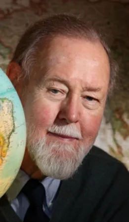
In the 1960s, a geographer named Roger Tomlinson was surveying potential sites for a paper mill in Kenya. He needed to consider the locations of monkey populations and elephant migration routes, topography and soil types, and he developed a computer application that would save him the headache of logging all the landscape features manually. He took the resulting technology, Geographic Information Systems (GIS) home to Canada, where he worked with the Canadian government to use GIS to map the country and track its population and urbanization. GIS went on to form the basis for such tools for daily living as Google Maps and MapQuest. Tomlinson was British by birth but received his Master’s degree in Geography from McGill University and went on to run an Ottawa- based geographic consulting firm.


